Ad

Showing posts with label geomagnetic activity. Show all posts

Thursday, May 23, 2013

7.4 Magnitude (possibly two back-to-back) Hits South of the Figi Islands. No Destructive Tsunami Detected.


Source of graphic: Nexrad, Intellicast


000
WEHW42 PHEB 231727
TIBHWX
HIZ001>003-005>009-012>014-016>021-023>026-231927-

TSUNAMI INFORMATION STATEMENT NUMBER   1
NWS PACIFIC TSUNAMI WARNING CENTER EWA BEACH HI
727 AM HST THU MAY 23 2013

TO - CIVIL DEFENSE IN THE STATE OF HAWAII

SUBJECT - TSUNAMI INFORMATION STATEMENT

THIS STATEMENT IS FOR INFORMATION ONLY. NO ACTION REQUIRED.

AN EARTHQUAKE HAS OCCURRED WITH THESE PRELIMINARY PARAMETERS

   ORIGIN TIME - 0719 AM HST 23 MAY 2013
   COORDINATES - 23.1 SOUTH  176.6 WEST
   LOCATION    - SOUTH OF THE FIJI ISLANDS
   MAGNITUDE   - 7.4  MOMENT

EVALUATION

 BASED ON ALL AVAILABLE DATA A DESTRUCTIVE PACIFIC-WIDE TSUNAMI IS
 NOT EXPECTED AND THERE IS NO TSUNAMI THREAT TO HAWAII. REPEAT. A
 DESTRUCTIVE PACIFIC-WIDE TSUNAMI IS NOT EXPECTED AND THERE IS NO
 TSUNAMI THREAT TO HAWAII.

THIS WILL BE THE ONLY STATEMENT ISSUED FOR THIS EVENT UNLESS
ADDITIONAL DATA ARE RECEIVED.

$$

Source: http://www.breakingnews.com

M7.4 - 282km SW of Vaini, Tonga2013-05-23 17:19:04 UTC

Event Time

  1. 2013-05-23 17:19:04 UTC
  2. 2013-05-23 05:19:04 UTC-12:00 at epicenter
  3. 2013-05-23 11:19:04 UTC-06:00 system time

Location

23.025°S 177.109°W depth=171.4km (106.5mi)

Nearby Cities

  1. 282km (175mi) SW of Vaini, Tonga
  2. 287km (178mi) SW of Nuku`alofa, Tonga
  3. 712km (442mi) SE of Suva, Fiji
  4. 812km (505mi) SE of Nadi, Fiji
  5. 818km (508mi) SSE of Lambasa, Fiji
  6. Tectonic Summary

    The May 23, 2013 Mw 7.4 earthquake southwest of Vaini, Tonga, occurred as a result of normal faulting at a depth of approximately 170 km. At the location of this earthquake, the Pacific and Australia plates are converging at a rate of approximately 73 mm/yr in an east-west direction, resulting in the westward subduction of the Pacific plate beneath Tonga at the Tonga-Kermadec trench. The depth and faulting mechanism of the May 23rd earthquake indicate it ruptured a fault within the subducting Pacific lithosphere rather than on the shallower thrust interface between the two plates.
    The Tonga-Kermadec arc has frequent moderate-to-large earthquakes, and has hosted over a dozen M6.5+ earthquakes within 500 km of the May 23rd earthquake over the past 40 years. Most of these also occurred at intermediate depths; the largest was an Mw 7.7 earthquake in October of 1997, approximately 110 km to the north-northeast of the May 23 2013 event. None are known to have caused significant damage. Intermediate-depth (70-300 km) and deep-focus (depth > 300 km) earthquakes are distinguished from shallow earthquakes (0-70 km) by the nature of their tectonic setting, and are in general less hazardous than their shallow counterparts, though they may be felt at great distances from their epicenters. The Tonga-Kermadec slab in the region of the May 23 2013 earthquake is seismically active to depths of over 650 km. 

    Seismotectonics of the Eastern Margin of the Australia Plate

    The eastern margin of the Australia plate is one of the most sesimically active areas of the world due to high rates of convergence between the Australia and Pacific plates. In the region of New Zealand, the 3000 km long Australia-Pacific plate boundary extends from south of Macquarie Island to the southern Kermadec Island chain. It includes an oceanic transform (the Macquarie Ridge), two oppositely verging subduction zones (Puysegur and Hikurangi), and a transpressive continental transform, the Alpine Fault through South Island, New Zealand.
    Since 1900 there have been 15 M7.5+ earthquakes recorded near New Zealand. Nine of these, and the four largest, occurred along or near the Macquarie Ridge, including the 1989 M8.2 event on the ridge itself, and the 2004 M8.1 event 200 km to the west of the plate boundary, reflecting intraplate deformation. The largest recorded earthquake in New Zealand itself was the 1931 M7.8 Hawke's Bay earthquake, which killed 256 people. The last M7.5+ earthquake along the Alpine Fault was 170 years ago; studies of the faults' strain accumulation suggest that similar events are likely to occur again.
    North of New Zealand, the Australia-Pacific boundary stretches east of Tonga and Fiji to 250 km south of Samoa. For 2,200 km the trench is approximately linear, and includes two segments where old (>120 Myr) Pacific oceanic lithosphere rapidly subducts westward (Kermadec and Tonga). At the northern end of the Tonga trench, the boundary curves sharply westward and changes along a 700 km-long segment from trench-normal subduction, to oblique subduction, to a left lateral transform-like structure.
    Australia-Pacific convergence rates increase northward from 60 mm/yr at the southern Kermadec trench to 90 mm/yr at the northern Tonga trench; however, significant back arc extension (or equivalently, slab rollback) causes the consumption rate of subducting Pacific lithosphere to be much faster. The spreading rate in the Havre trough, west of the Kermadec trench, increases northward from 8 to 20 mm/yr. The southern tip of this spreading center is propagating into the North Island of New Zealand, rifting it apart. In the southern Lau Basin, west of the Tonga trench, the spreading rate increases northward from 60 to 90 mm/yr, and in the northern Lau Basin, multiple spreading centers result in an extension rate as high as 160 mm/yr. The overall subduction velocity of the Pacific plate is the vector sum of Australia-Pacific velocity and back arc spreading velocity: thus it increases northward along the Kermadec trench from 70 to 100 mm/yr, and along the Tonga trench from 150 to 240 mm/yr.
    The Kermadec-Tonga subduction zone generates many large earthquakes on the interface between the descending Pacific and overriding Australia plates, within the two plates themselves and, less frequently, near the outer rise of the Pacific plate east of the trench. Since 1900, 40 M7.5+ earthquakes have been recorded, mostly north of 30°S. However, it is unclear whether any of the few historic M8+ events that have occurred close to the plate boundary were underthrusting events on the plate interface, or were intraplate earthquakes. On September 29, 2009, one of the largest normal fault (outer rise) earthquakes ever recorded (M8.1) occurred south of Samoa, 40 km east of the Tonga trench, generating a tsunami that killed at least 180 people.
    Across the North Fiji Basin and to the west of the Vanuatu Islands, the Australia plate again subducts eastwards beneath the Pacific, at the North New Hebrides trench. At the southern end of this trench, east of the Loyalty Islands, the plate boundary curves east into an oceanic transform-like structure analogous to the one north of Tonga.
    Australia-Pacific convergence rates increase northward from 80 to 90 mm/yr along the North New Hebrides trench, but the Australia plate consumption rate is increased by extension in the back arc and in the North Fiji Basin. Back arc spreading occurs at a rate of 50 mm/yr along most of the subduction zone, except near ~15°S, where the D'Entrecasteaux ridge intersects the trench and causes localized compression of 50 mm/yr in the back arc. Therefore, the Australia plate subduction velocity ranges from 120 mm/yr at the southern end of the North New Hebrides trench, to 40 mm/yr at the D'Entrecasteaux ridge-trench intersection, to 170 mm/yr at the northern end of the trench.
    Large earthquakes are common along the North New Hebrides trench and have mechanisms associated with subduction tectonics, though occasional strike slip earthquakes occur near the subduction of the D'Entrecasteaux ridge. Within the subduction zone 34 M7.5+ earthquakes have been recorded since 1900. On October 7, 2009, a large interplate thrust fault earthquake (M7.6) in the northern North New Hebrides subduction zone was followed 15 minutes later by an even larger interplate event (M7.8) 60 km to the north. It is likely that the first event triggered the second of the so-called earthquake "doublet".
    source: 

Thursday, May 9, 2013

Ring of Fire Solar Eclipse Today. Solar Forecast


RING OF FIRE SOLAR ECLIPSE--TODAY! On May 9-10, the Moon will pass directly in front of the sun over the South Pacific, producing a "ring of fire" solar eclipse. At greatest eclipse, more than 95% of the sun's surface will be covered. The Coca-Cola Space Science Center is hosting a live webcast of the event from Australia! Tune in on May 9th beginning at 5 pm EDT. More: animation, map,details.

MAGNETIC ACTIVITY: A ragged, dynamic filament of magnetism is dancing along the sun's southwestern limb today. It is so large, more than 250,000 km from end to end, that amateur astronomers are able to see it in great detail using backyard solar telescopes. John Stetson sends this snapshot from Falmouth, Maine:
The magnetic underpinnings of this arching prominence may be connected to nearby sunspot AR1736, which is itself unstable and poses a threat for M-class solar flares. If the anchor is unstable, the overlying structure could collapse. Observers with solar telescopes are encouraged to monitor the southwestern limb for developments.

Solar wind
speed: 451.5 km/sec
density: 3.4 protons/cm3
explanation | more dataUpdated: Today at 0037 UT
X-ray Solar Flares
6-hr max: C9 
2316 UT May09 
24-hr: C9 
2316 UT May09 
explanation | more dataUpdated: Today at: 2359 UT


Near Earth Asteroids
Potentially Hazardous Asteroids (PHAs) are space rocks larger than approximately 100m that can come closer to Earth than 0.05 AU. None of the known PHAs is on a collision course with our planet, although astronomers are finding new ones all the time.
On May 10, 2013 there were 1397 potentially hazardous asteroids.
Recent & Upcoming Earth-asteroid encounters:
Asteroid
Date(UT)
Miss Distance
Size
2013 JR7
May 10
9.1 LD
18 m
2004 BV102
May 25
69.9 LD
1.4 km
1998 QE2
May 31
15.2 LD
2.1 km
2009 FE
Jun 4
9.6 LD
230 m
2000 FM10
Jun 5
50.3 LD
1.3 km
2002 KL3
Jun 6
66.4 LD
1.1 km
1999 WC2
Jun 12
39.2 LD
1.9 km
2006 RO36
Jun 18
70.9 LD
1.2 km
2001 PJ9
Jul 17
29.2 LD
1.1 km
2006 BL8
Jul 26
9.3 LD
48 m
2003 DZ15
Jul 29
7.6 LD
153 m
2005 WK4
Aug 9
8.1 LD
420 m
Notes: LD means "Lunar Distance." 1 LD = 384,401 km, the distance between Earth and the Moon. 1 LD also equals 0.00256 AU. MAG is the visual magnitude of the asteroid on the date of closest approach.

Source:  SpaceWeather.com

3-day GOES X-ray Plot
The GOES X-ray Flux plot contains 5 minute averages of solar X-ray output in the 1-8 Angstrom (0.1-0.8 nm) and 0.5-4.0 Angstrom (0.05-0.4 nm) passbands. Data from the SWPC Primary and Secondary GOES X-ray satellites are shown. Some data dropouts from the Primary satellite will occur during satellite eclipses.
Other plots of interest: A black background version of this plot; GOES 1-min X-rays; SWPC Real-time Monitors. 
SWPC X-ray alerts are issued at the M5 (5x10E-5 Watts/m2) and X1 (1x10E-4 Watts/m2) levels, based upon 1-minute data. Large X-ray bursts cause short wave fades for HF propagation paths through the sunlit hemisphere. Some large flares are accompanied by strong solar radio bursts that may interfere with satellite downlinks.
source: http://www.swpc.noaa.gov/rt_plots/xray_5m.html


List Of The Potentially Hazardous Asteroids (PHAs)


Friday, March 15, 2013

Solar Activity Alert


WILL THE SKY TURN GREEN ON ST. PATRICK'S DAY? A magnetic filament snaking around sunspot AR1692 erupted on March 15th at about 0600 UT. The slow explosion, which took hours to unfold, produced an M1-class solar flare and a bright CME. SOHO (the Solar and Heliospheric Observatory) photographed the expanding cloud, which is heading directly toward Earth:


The CME left the sun traveling some 900 km/s (2 million mph). Three-dimensional computer models based on observations from SOHO and NASA's twin STEREO probes predict the CME will cross the void between sun and Earth in two days or less. NOAA forecasters estimate a 70% chance of polar geomagnetic storms when the cloud arrives on March 17th. This means the sky could turn green on St. Patrick's Day! High latitude (and possibly even middle latitude) sky watchers should be alert for auroras this weekend. 

Solar wind
speed: 447.1 km/sec
density: 1.6 protons/cm3
explanation | more dataUpdated: Today at 0117 UT


EVIDENTLY THE SOLAR WIND IS AFFECTING US MUCH MORE THAN IS USUALLY PUBLICLY LET ON...


Meeting on Solar Wind Turbulence in Kennebunkport, Maine, USA

 
06/04/2013 - 00:00
06/07/2013 - 23:59
Etc/GMT+1
Our goal is somewhat different from more familiar conferences and is designed with the SHINE model in mind. We are inviting very few speakers who we are asking to give review and introductory talks for each topic we hope to discuss. Those invited review talks will be largely non-controversial and focus upon agreed-upon results. They are also likely to contain challenges for the participants to explain. Then, the bulk of the time is left unscheduled and we ask the participants to give short, focused talks that lead to discussion and debate on the fundamental aspects of the subject at hand.
We expect that everyone who attends will have ample opportunity to enter into the debate and we hope to stimulate a lively discussion of fundamental physics.
We hope you will join us. Bring multiple 5-minute talks that attempt to make specific points so you can enter into the debate clearly and propel the discussion forward. No one is expected to be given a large block of time to speak. The goal is meaningful and focused debate. Remember, you may not convince everyone, but there will be many participants who want to understand your point of view. Our goal is to debate and illuminate, providing inspiration to all.

THE SOLAR PROBE PLUS WORKSHOP
THE first Solar Probe Plus Workshop will take place at the Beckman Institute auditorium, California Institute of Technology, Pasadena, from March 26th to 29th, 2013. SPP1 will introduce the Heliophysics community to the mission and prepare for the exciting discoveries that the Solar Probe Plus mission will make. The Workshop will explore the scientific objectives of the Solar Probe Mission and how the direct exploration of the corona and inner heliosphere will lead to advances in our understanding of coronal heating and solar wind acceleration, the magnetic and plasma structure of the heliosphere, and the acceleration of energetic particles at shocks and flares. The workshop will inspire research that will make use of the SPP observations within the context of the NASA Heliophysics Observatory System and identify key areas for preparatory research. Synergistic observations from other ground based and space based assets will also be addressed.

The meeting is composed of 4 sessions:
  1. Heating and acceleration of the solar corona and solar wind.
  2. Structure and dynamics of the plasma and magnetic fields at the sources of the solar wind.
  3. Particle acceleration and transport from the corona into the inner heliosphere
  4. Solar Probe Plus Synergies: maximizing scientific return in conjunction with the Heliophysics Observatory System and ground based assets.


SH11: Solar Wind Structure and Its Coronal Origins


The recent solar cycle 23-24 transition, together with the availability of multiperspective, multipoint in-situ observations and sophisticated 3D coronal and heliospheric models, has opened our eyes to the complex origins of the solar wind, even at solar minima. In particular we now see that a weak field solar cycle may in fact add complexity because of the existence of many low-to-mid latitude coronal holes and coronal pseudostreamers. Indeed the corona through most of the recent minimum had the appearance of a high solar activity phase even though sunspot number remained low. This session will focus on the many aspects of this condition, and consequences for past and future cycles during which the solar dynamo produces weak fields.

MANY OTHER MEETINGS HAVE BEEN HELD ON THE SUBJECT.


Saturday, January 12, 2013

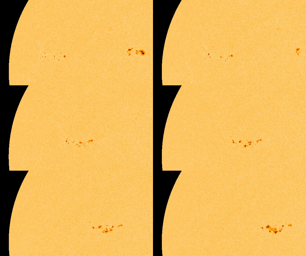
Sunspot AR1654 Threatens to Shoot Off Huge Eruptions Towards Earth


ACTIVE SUNSPOT: Big sunspot AR1654 is crackling with C- and M-class solar flares, and it poses a threat for even stronger eruptions. NOAA forecasters estimate a 5% chance of X-flares today. 

Flares are illuminating the sunspot's magnetic canopy like flash bulbs at a rock concert; the phenomenon is evident in this 37-hour extreme ultraviolet movie from NASA's Solar Dynamics Observatory:


Since it first appeared four days ago, sunspot AR1654 has been facing away from Earth. But now it is turning toward us, increasing the "geo-effectiveness" of its explosions. This could be the sunspot that breaks the recent lengthy spell of calm space weather around our planet.

Amateur astronomers with backyard solar telescopes are encouraged to monitor in the days ahead. It is not only crackling, but also growing. As of Jan 12th, the behemoth stretches more than 180,000 km (14 Earth diameters) from end to end. Dennis Simmons sends this picture of the behemoth from Brisbane, Australia:


"Although the air was milky from nearby bush fires burning north of Brisbane, the seeing turned out to be good enough for a high-resolution shot," says Simmons. "I dedicate this image to the brave Australian fire fighters, working in horrendous, hot and windy conditions whilst fighting fires burning out of control across the south-east states of our country. I salute your selfless courage."


SPACE WEATHER
NOAA Forecasts
Updated at: 2013 Jan 12 2200 UTC
FLARE
0-24 hr
24-48 hr
CLASS M
65 %
65 %
CLASS X
10 %
10 %

source: http://spaceweather.com/

Wednesday, November 21, 2012

Solar Activity Increasing Extensively.


Visit NBCNews.com for breaking news, world news, and news about the economy

This intense period of solar activity isn't unexpected; it's all part of the natural solar cycle that ebbs and flows over an approximate 11-year cycle. The peak of this cycle, called "solar maximum," is expected in 2013, but in the run-up to the crescendo, the sun has been increasingly active.
Solar max represents a period when the sun's magnetic field is at its most stressed, so magnetic features like coronal loops and prominences are often observed in the sun's atmosphere (the corona). Explosive events like CMEs and flares also become commonplace. The solar wind -- a stream of charged particles that constantly flow into interplanetary space -- also becomes amplified.
All of these factors can impact our planet's magnetic field, increasing the chances of radiation and geomagnetic storms -- magical light shows in the form of aurorae are often a result of this geomagnetic battle. Solar storms can also impact our increasingly high-tech society, a fact not lost on the world's space weather prediction efforts.
source: http://news.discovery.com/space/will-the-sun-unleash-a-thanksgiving-flare-121121.html


Fire in the Sky

Scientists warn of a solar flare large enough to paralyze our electrified world

By Joan Trossman Bien 11/21/2012
If you have never heard of an electromagnetic pulse, or EMP, then you have not spent any time worrying about an EMP causing the end of civilization as we know it.
  
But scientists and some policymakers worry about such a thing happening, and for very good reason.
 
If an EMP were to occur over the United States, caused either by a particularly violent solar storm or by a small nuclear device detonated many miles above the ground, chances are high that the country’s entire electrical grid would fail, as a massive surge of electricity would fry the huge transformers that keep the grid humming. Satellites we rely on for navigation and communication would be damaged beyond repair, and society would crumble into a dysfunctional scramble for survival. The very necessities of life, such as clean water, food, medications, transportation, even government, would all either disappear or be in very short supply. 
 
There are sharp differences of opinion among experts regarding the likelihood of an EMP occurring anytime soon. But, nuclear attack aside, given the fact that extreme solar events happen once or twice a decade, “It is just a question of not if, but when the Earth happens to be in the path of these kinds of [solar] storms,” according to Dan Baker, director of Laboratory for Atmospheric and Space Physics (LASP) at the University of Colorado.

Big changes
What exactly is a solar flare and why should anyone care? 
 
Marco Velli, a senior researcher at NASA’s Jet Propulsion Laboratory whose expertise is in solar research, has been named principal investigator for NASA’s Solar Probe Plus, scheduled to launch in 2018. The project will place a satellite into orbit around the sun — inside its corona, far closer than ever before — as part of a mission to study solar weather.
 
“A solar flare is essentially an explosion,” Velli explained, adding that it sends out a huge amount of plasma or high-energy gas from the sun called coronal mass ejections (CMEs). “The energy is equivalent to several thousand atomic bombs … accelerating high energy particles to very high speeds, like cosmic rays.”
 
The potential damage, Velli added, depends on where the blast actually hits.
 
“When one of these big CMEs takes off and is directed toward Earth, it can cause big changes in the Earth’s magnetic field. This can induce currents in the Earth’s ionosphere and also in things on the ground, like big power stations, and it can disrupt the grid. It is the kind of thing that can fry the transformers so they cannot be used again. That’s bad,” he said.
 
Dr. Edwin Krupp, director of the Griffith Observatory in Griffith Park, put this fairly common event of solar flares into perspective. 
 
“For thousands of years, the only impact was the display of the aurora borealis. It didn’t have much of an influence on life on Earth until the era of high technology,” Krupp said.
 
Baker described how our lives have changed so quickly. 
 
“I like to say that modern humans have embedded us within a cyber-electric cocoon that surrounds the entire Earth. In many ways, every one of our modern technologies can be affected by solar storms,” he said.
 
Experts agree that the most damaging aspects of a solar storm are large CMEs, which, Baker said, “are very large blobs of material that are expelled from the sun and can be huge in dimension. It is often noted that the largest of these can be moving at many millions of miles an hour.”
 
Explaining how CMEs damage electronics, Baker said, “When one of these big CMEs takes off, when it is directed towards the Earth, it can cause big changes in the Earth’s magnetic field. It can charge up the Earth’s magnetosphere with strong, high-energy particles as well. This can induce currents in the Earth’s ionosphere and also in things on the ground, like big power stations, and it can disrupt the grid.”

Solar superstorm
The Big Daddy of modern solar storms, called the Carrington Event for well-known British amateur astronomer Richard Carrington, occurred on Sept. 1, 1859.
 
At the time, Carrington was just setting up his London solar observatory to chart an active solar storm. The telescope aimed at the sun projected an image that Carrington could trace on paper.  As he was drawing the sunspots, according to modern-day accounts from a number of Web sites covering the subject, “two patches of intensely bright and white light” appeared on his screen. They were located in one large group of sunspots. Carrington left the room to notify another scientist, but by the time he returned about five minutes later, the event had ended. Another amateur astronomer, Roger Hodgson, also observed the phenomenon. Over at Kew Observatory in London, a magnetometer needle dangled from a thread. It began to flail and bounce. They had just observed the beginnings of a solar super storm. 
Fire in the Sky 
Before dawn the next morning, the skies went psychedelic with auroras as far south as Hawaii and Panama. Bright swirls of reds, greens and purples lit up the still-dark early morning skies. Baker reported at a geophysics meeting in 2010 that the light was so bright, “people in the northeastern US could read newspaper print just from the light of the aurora.”
 
The Charleston Mercury ran a first-person account from a woman on Sullivan’s Island in South Carolina. “The eastern sky appeared of a blood red color,” she wrote. “It seemed brightest exactly in the east, as though the full moon, or rather the sun, was about to rise. It extended almost to the zenith. The whole island was illuminated. The sea reflected the phenomenon, and no one could look at it without thinking of the passage in the Bible, which says, ‘the sea was turned to blood.’ The shells on the beach, reflecting light, resembled coals of fire.”
 
The New York Times reported that people stood on rooftops and gathered on sidewalks to watch “the heavens … arrayed in a drapery more gorgeous than they had been for years.”
 
The most sophisticated mode of communication at the time was the telegraph, and when the supercharged CME hit the Earth’s magnetic field, telegraph wires surged with the electrical currents. It blew out the machines at some places. At others, the sparks caused fires. When operators turned off their batteries, the telegraph machines continued to work. 
The Carrington Event was extraordinarily huge. Ice core samples have revealed it was double the size of any other solar storm in the preceding 500 years. And scientists say it will happen again, possibly soon.

Dodging bullets
Solar flares are not unusual.  On March 13, 1989, a CME blew out power in Quebec, leaving 6 million people in the dark. In 1921, a solar storm hit, but didn’t cause much damage. Today, such an occurrence would have darkened half of North America. 
 
Last summer, Baker said there was a very close call. “Just on July 22, there was a very ugly, mean-looking active region on the sun that had moved across the face of the sun. A satellite was watching it. A huge flare, and then a CME, came at the spacecraft and it was moving at the highest recorded speed that has been seen in the modern Space Age. It reached the satellite in 17 hours. That’s an hour faster than the Carrington Event, and it led to extremely intense magnetic fields in the interplanetary medium. For all intents and purposes, that was a Carrington Event that just missed us. We dodged the proverbial bullet there. Now we know there have been others like this.”
 
Can it happen again? “Some people say that the Carrington Event is a moldy old event and these things happen only once in 1,000 years,” Baker said. “I think recent work has suggested quite the contrary. The probability of any of these occurring during one 11-year cycle of solar storms is like 10 percent, a pretty significant probability. It’s not a rare thing.”
 
Ultimately, whether triggered by a rogue nation’s high-altitude detonation of a small nuclear weapon or set off by a rare but possible extremely strong solar flare, the result will be the same if we continue to do nothing. 

A perfect solar storm
Not all experts agree with Baker about the chances of a Carrington Event-type of CME causing the lights to go out. In fact, there has been some recent commentary about the analysis of solar flares that have occurred over the past 50 years. 
 
Solar storms occur in cycles of about 11 years. We are now entering what has been described as a very active part of the 11 year cycle. It is called the solar maximum, and the scientific community believes that it could be quite potent.
Baker described a worst-case scenario:
 
“When these huge clouds of material move out at such high speeds, a powerful shockwave can form in front of them. The CMEs can also have embedded within them much stronger magnetic fields, and this entire cloud can, in turn, lead to the acceleration of charged particles. It is sort of the perfect solar storm that’s headed directly at Earth. Those currents get coupled into very long power lines on a continental scale, the power grid. That is the one thing that we worry about most from solar storms — the effect these CMEs can have on the power grid.”


M-CLASS SOLAR FLARES: The magnetic canopy of big sunspot AR1618 is crackling with M-class solar flares. This image taken by NASA's Solar Dynamics Observatory shows the extreme ultraviolet flash from one of them, an M1.6-class flare on Nov. 20th at 1928 UT:
This eruption, and another one like it about 7 hours earlier, might have propelled faint coronal mass ejections (CMEs) toward Earth. If so, the impacts would likely commence on Nov. 23rd, with a chance of high-latitude geomagnetic storms following their arrival. Stay tuned for updates. Aurora alerts: text, voice.
FAST-GROWING SUNSPOT (Updated Nov. 21): Only a few days ago, sunspot AR1618 was almost invisible. Now it is a behemoth more than 10 times wider than Earth. A movie from NASA's Solar Dynamics Observatory shows the sunspot's development on Nov. 20-21:
As the sunspot evolves, so does its intense magnetic field--and this means strong flares are in the offing. Fast-changing magnetic fields on the sun have a tendency toreconnect and erupt. NOAA forecasters estimate a 70% chance of M-class flares and a 15% chance of X-flares during the next 24 hours. Because of the sunspot's nearly central location on the solar disk, any eruptions will likely be Earth-directed.Solar flare alerts: text, voice.


SPACE WEATHERNOAA Forecasts
Updated at: 2012 Nov 21 2200 UTC
FLARE
0-24 hr
24-48 hr
CLASS M
70 %
70 %
CLASS X
30 %
30 %


source: http://spaceweather.com/

latest solar x-ray graph

source: http://www.swpc.noaa.gov/

Double Prominence Eruptions

Double Prominence Eruptions
The Sun erupted with two prominence eruptions, one after the other over a four-hour period (Nov. 16, 2012). The action was captured in the 304 Angstrom wavelength of extreme ultraviolet light. It seems possible that the disruption to the Sun's magnetic field might have triggered the second event since they were in relatively close proximity to each other. The expanding particle clouds heading into space do not appear to be Earth-directed.

Saturday, April 28, 2012

Active Sunspot Turns Toward Earth. Earthquake Activity Increases Again.

Latest GOES Solar X-ray Image, link to large imageInterestingly, while the Sunspot activity has been pointed away from the Earth, the earthquake activity has calmed down to a scary low.  I say "scary" because, as low as the earthquake activity has become, the pressure build up that may cause a rather large, if not a mega earthquake is much higher during this time.  


Today, with the Sunspot activity turning Earthward bound, the seismic activity has slowly started to increase again.   With all things in this solar system connected by magnetic and other energy forces, we are sure to see another phase of earthquake, weather, volcanic, and other activity.


Just for today, up to this point (12:51pm MST), here is the list of earthquakes, which, by-the-way, includes one large 6.7 quake...


Update time = Sat Apr 28 18:31:14 UTC 2012
MAGUTC DATE-TIME
y/m/d h:m:s
LAT
deg
LON
deg
DEPTH
km
 Region
MAP 5.3  2012/04/28 18:00:36   -3.304   100.405 31.0  KEPULAUAN MENTAWAI REGION, INDONESIA
MAP 2.5  2012/04/28 17:14:38   36.182  -120.302 11.1  CENTRAL CALIFORNIA
MAP 4.3  2012/04/28 17:11:59   73.067   6.327 9.9  GREENLAND SEA
MAP 4.4  2012/04/28 16:24:54  -24.138   -66.659 187.6  JUJUY, ARGENTINA
MAP 2.5  2012/04/28 15:11:26   36.053  -117.878 5.5  CENTRAL CALIFORNIA
MAP 3.8  2012/04/28 15:07:28   34.234  -117.434 13.5  SOUTHERN CALIFORNIA
MAP 3.0  2012/04/28 14:33:07   18.908   -67.196 21.0  PUERTO RICO REGION
MAP 6.7  2012/04/28 10:08:08  -18.643  -174.725 129.4  TONGA
MAP 2.8  2012/04/28 05:48:20   18.915   -67.794 19.0  DOMINICAN REPUBLIC REGION
MAP 2.5  2012/04/28 05:36:28   33.661  -116.764 17.9  SOUTHERN CALIFORNIA
MAP 4.5  2012/04/28 03:42:24   50.594  -129.774 15.5  VANCOUVER ISLAND, CANADA REGION
MAP 4.7  2012/04/28 03:17:06   38.395   40.789 5.1  EASTERN TURKEY
MAP 2.8  2012/04/28 02:14:25   35.528   -96.766 4.8  OKLAHOMA

source: USGS


Here is the current Space Weather data and forecast...


CHANCE OF FLARES: Sunspot AR1465 has developed a 'beta-gamma-delta' magnetic field that harbors energy for strong flares. NOAA forecasters estimate a20% chance of M-class eruptions during the next 24 hours. Because the active region is located on the Earthside of the sun, any flares from AR1465 will likely be geoeffective.

Even without a strong eruption from AR1465, ionization waves are already rippling through Earth's upper atmosphere. Dave Gradwell of Birr, Ireland, recorded a series of sudden ionospheric disturbances (SIDs) on April 27th:
Low-level flares from several sunspot groups (especially 1465, 1466 and 1467) are strobing the atmosphere with ionizing radiation. Using a VLF receiver, Gradwell detected their effect on the propagation of radio signals transmitted from France. So far the disturbances have been relatively weak, but this could change if AR1465 unleashes a more potent eruption over the weekend. Solar flare alerts: text, phone.

source:  SPACE WEATHER

To keep you aware of earthquake news, this is what has been reported today, April 28, 2012...

Southern California earthquake downgraded to magnitude 3.8

Population Exposure Map
An earthquake that hit Southern California on Saturday morning was downgraded from a magnitude 4.1 to 3.8.
The quake, centered near the San Andreas Fault, was felt over a large swath of the region, according to the U.S. Geological Survey's "Did You Feel It?" website, including Northridge, Marina del Rey, downtown Los Angeles, Long Beach and West Hollywood.
But the strongest jolt was felt near the epicenter in Devore, about 60 miles east of downtown Los Angeles.
The temblor struck at 8:07 a.m. No damage or injuries were reported.
A 2.0 aftershock was reported nearby a short time later.
The San Andreas Fault is one of California's most active and potentially dangerous, capable of producing the catastrophic quake euphemistically known as as the Big One, seismologists say. Saturday's quake, however, was considered small.
source: LA TIMES

Still No Earthquake Study by Well Operator

April 28, 2012
The Intelligencer / Wheeling News-Register
COLUMBUS, Ohio (AP) - The operator of a northeast Ohio deep-injection well tied to earthquakes in the area has yet to receive the state clearance it says is necessary to conduct independent seismic research aimed at proving the well wasn't the cause of the quakes.
Documents show D&L Energy in Youngstown sought state permission in February to re-open the shuttered well - after plugging it to a shallower depth - and then to measure the vibrations for its analysis. The Ohio Department of Natural Resources has yet to respond, in what could signal a permanent delay.
D&L closed the Youngstown well after a New Year's Eve quake reached 4.0 magnitude. The state then imposed a moratorium on deep-injection drilling near the site, halting regional disposal of millions of gallons of wastewater from hydraulic fracturing for natural gas or oil and other forms of drilling.
ODNR spokesman Carlo LoParo said Friday the state can't approve the request as long as the indefinite moratorium is in place.
A March 9 state report tied the well to the quakes and imposed new state regulations on deep-injection activity.
The state review pointed to previously unidentified fault lines under the well site, which reached 8,000 to 9,000 feet below ground, as the likely source of the quakes. Smaller tremblers had been occurring over the well's first year or so of operation, but it wasn't until back-to-back quakes on Christmas Eve and New Year's Eve that the issue grabbed widespread public attention.
D&L had said it would hire its own independent consultants to study the earthquakes, with the hope of disproving any link and getting the year-old well re-opened.
Company spokesman Vince Bevacqua said D&L is still waiting for the agency's guidance on its Feb. 28 letter.
In it, the company proposed procedures its consultants, Schlumberger Reservoir Group and Microseismic Inc., would undertake to plug North Star No. 1 in Youngstown to a shallower depth, re-start operations, and monitor for seismic activity going forward. The letter also addressed procedures at three other wells the company operates within a 7-mile radius.
Bevacqua said in an e-mail that the company's independent studies "would proceed contingent on ODNR's approval." He declined to interpret the delay as a bad sign for the well's future.
"D&L makes no assumption about ODNR's intentions and continues to work cooperatively with the agency pending the resolution of these matters," he said in an e-mail.
LoParo said that shouldn't stop D&L from seeking answers about the quakes.
"They can conduct a comprehensive review of their well regarding the activity that occurred in the past year, and all possible induced seismic activity, without state approval," he said. "It is their well, it is their property. If they want to analyze the geography surrounding the well, if they want to analyze the well itself, collect core samples, study previous injection, they're certainly free to go with that."
READ MORE AT NEWS-REGISTER

6.7-magnitude earthquake shakes islands in Tonga

NEIAFU, TONGA (BNO NEWS) -- A strong earthquake struck just off the Pacific island nation of Tonga on late Saturday evening, seismologists said, but there were no immediate reports of damage or casualties.
The 6.7-magnitude earthquake at 11:08 p.m. local time (1008 GMT) was centered about 78 kilometers (48 miles) west of Neiafu, a town on the island of Vava'u. It struck about 129.4 kilometers (80.4 miles) deep, making it an earthquake with intermediate depth, according to the United States Geological Survey (USGS).
The USGS said no damage was to be expected but estimated that some 123,000 people living on islands near the epicenter may have felt light to moderate shaking. Several residents on a nearby island confirmed they felt light shaking, but there were no immediate reports of damage or casualties.
Because earthquakes with a magnitude below 7 do usually not generate tsunamis, no tsunami alert was issued. "A destructive tsunami was not generated based on earthquake and historical tsunami data," the Pacific Tsunami Warning Center said in a bulletin.
TongaTonga is on the so-called 'Pacific Ring of Fire', an arc of fault lines circling the Pacific Basin that is prone to frequent and large earthquakes. Volcanic eruptions also occur frequently in the region, which is one of the most geologically active parts in the world.
Tonga, with a total population of around 104,000 people, is made up of 169 islands sprinkled over the Pacific Ocean about one-third of the way from New Zealand to Hawaii. Only thirty-nine of the islands are inhabited.
On September 29, 2009, an 8.1-magnitude earthquake struck 185 kilometers (115 miles) east-northeast of Hihifo on Tonga, unleashing large tsunamis that killed nearly 200 people and injured hundreds more in Tonga, American Samoa, Samoa, and other nearby islands.
SOURCE: MINEWS26.COM


The READI GPS network can accurately pinpoint details about larger earthquakes, which can help government agencies properly predict the tsunamis that follow NASA will test a new system for collecting information on earthquakes, which is intended for disaster response, across the western United States. 


 The new system is called the Real-time Earthquake Analysis for Disaster (READI) Mitigation Network, and it was created by researchers at Scripps at the University of California in San Diego, the University of Nevada in Reno, Central Washington University in Ellensburg, the University of California at Berkeley, UNAVCO in Colorado, and the California Institute of Technology/Jet Propulsion Laboratory in Pasadena. 


These institutions used years of research from the likes of NASA, the National Science Foundation, the U.S. Geological Survey and the Department of Defense to make the network. In fact, these agencies along with federal and state partners are helping to support the READI network. 


The READI network is based on global positioning system (GPS) data, which is capable of calculating important information of earthquakes such as location, fault rupture details and magnitude. READI aims to particularly target larger earthquakes with a magnitude of 6.0 and stronger. 


There is great need for a system that can readily detect and monitor stronger earthquakes because it is currently difficult to obtain data such as location and magnitude using conventional instruments that simply measure ground shaking. By using the READI network, this data can be easily acquired on a strong earthquake and can then be used to calculate the strength of a following tsunami. 


 "Conventional seismic networks have consistently struggled to rapidly identify the true size of great earthquakes during the last decade," said Timothy Melbourne, director of the Central Washington University's Pacific Northwest Geodetic Array. 


"This GPS system is more likely to provide accurate and rapid estimates of the location and amount of fault slip to fire, utility, medical and other first-response teams." 


 With better tsunami predictions, agencies like the U.S. Geological Survey (USGS) and the National Oceanic and Atmospheric Administration (NOAA) will be able to issue more accurate and timely warnings.  


"With the READI network we are enabling continued development of real-time GPS technologies to advance national and international early warning disaster systems," said Craig Dobson, natural hazards program manager in the Earth Science Division at NASA Headquarters in Washington. "This prototype system is a significant step towards realizing the goal of providing Pacific basin-wide natural hazards capability around the Pacific 'Ring of Fire.'" 


NASA will test the READI network this year using 500 stations throughout California, Oregon and Washington.


SOURCE: DAILY TECH.COM